Why Buy a Long Endurance UAV Drone?
A Long Endurance UAV Drone can keep cameras, communications equipment, or environmental sensors working across a wide area. That matters when a survey site is remote, a coastline stretches beyond easy reach, or a team needs repeated observations. More flight time can mean fewer landings and less interruption. But endurance alone does not guarantee a useful mission.
UAV researcher Kimon P. Valavanis’s book title, Advances in Unmanned Aerial Vehicles: State of the Art and the Road to Autonomy, offers a useful expert framing: aircraft capability must serve a clear operational purpose. It is a title, not a claim that endurance solves every challenge. A buyer should compare payload weight, wind tolerance, launch requirements, data links, maintenance, and the time needed to replace batteries or refuel. Small details matter. A sensor that adds weight can shorten flight time; a distant landing site can complicate recovery.
The best choice depends on the work. A mapping team may value steady coverage, while an inspection crew may need precise control near structures. Ask for performance figures under realistic payload and weather conditions, not just an ideal endurance number. Check the assumptions. Long-range operation also requires trained operators, safe procedures, and compliance with applicable aviation rules. Some specifications can look impressive on paper, yet prove less useful in the field. A careful assessment helps determine whether a Long Endurance UAV Drone delivers practical value—or simply stays airborne longer.
What Defines a Long-Endurance UAV Drone?
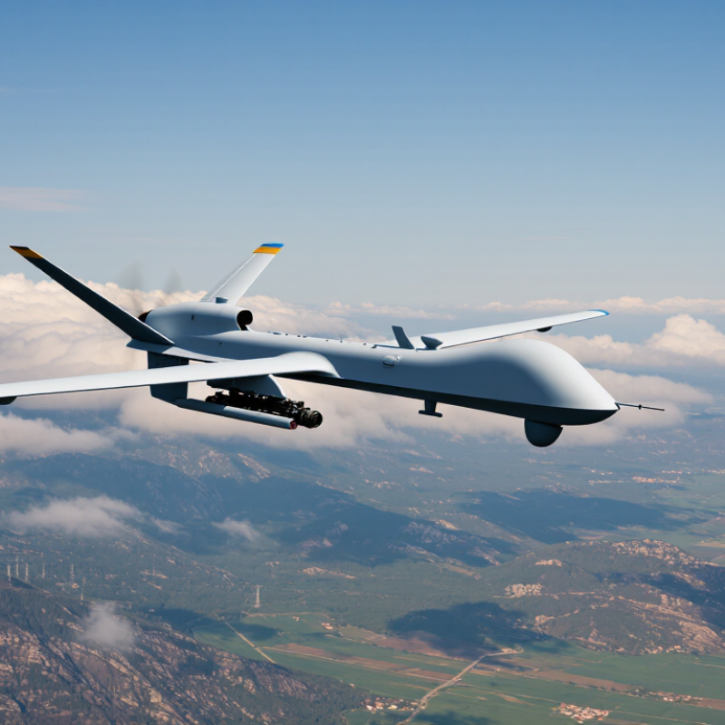
A long-endurance UAV drone is designed to remain airborne for extended periods, rather than complete a brief flight and return quickly. There is no single industry-wide flight-time cutoff that defines “long endurance.” The term depends on the aircraft class and mission. A small multirotor may be considered long-endurance after a few hours, while a fixed-wing platform may stay aloft much longer. It is about sustained flight.
Endurance is not the same as range. A drone can fly slowly in a holding pattern for many hours yet cover less ground than a faster aircraft. Its real flight time depends on energy capacity, propulsion efficiency, payload weight, wind, temperature, and reserve requirements. A heavier camera or sensor can shorten a planned mission noticeably. Even careful estimates can be wrong; field conditions are rarely tidy. Reliable specifications should explain the test setup, payload, and operating conditions, not just give a headline number.
Tips: Compare endurance figures under similar payload and weather conditions. Check what equipment was installed, whether the aircraft was moving or loitering, and how much reserve remained at landing. A clear test method matters.
How Extended Flight Time Supports Different Missions
A long-endurance UAV is useful when a mission covers more ground than one short flight can manage. A coastal survey, for example, may follow a shoreline for hours, capturing overlapping images of dunes, erosion, and access paths. Longer airtime can reduce landing breaks and battery changes, helping teams maintain a steadier survey pattern. Small details matter. Consistent altitude and camera settings make images easier to compare later, though wind or changing light can still affect results.
Different missions benefit in different ways. During infrastructure inspections, extended flight can let a trained crew examine a long route without repeatedly repositioning the aircraft. For environmental monitoring, it can support repeated observations across a broad area, while emergency teams may use it to assess roads or flood boundaries from a safe distance. More flight time is not automatically better. Operators still need to monitor battery reserves, weather, signal quality, and image clarity throughout the mission. A longer flight can also mean more data to review, and that workload is easy to underestimate. When endurance matches the task, teams can spend less time resetting and more time collecting useful, consistent information.
Operational Advantages of Long-Endurance UAVs
Long-endurance UAVs can keep a sensor over a work area for hours, reducing gaps between observation passes. That matters. On a pipeline survey, for example, a crew can follow a long route without repeatedly landing to change batteries. Fewer interruptions may also mean fewer takeoffs, less setup time, and more consistent image overlap for later mapping.
The extra time aloft supports tasks that depend on watching change, not just collecting a single snapshot. A thermal camera can track heat patterns across a remote site, while an optical sensor records shifts in vegetation or shoreline conditions. Operators can plan a steady flight path, monitor battery reserves, and send selected images to a field station during the mission. This helps teams make timely decisions without moving people into difficult terrain.
Endurance is useful, but it is not a substitute for good mission planning. Wind, rain, payload weight, and communications limits can shorten a flight or reduce data quality. Not always. A heavier sensor may provide better detail but consume more power, so teams must balance coverage against resolution. Long flights can also create more footage than crews can review; clear collection goals and reliable data handling remain essential.
Costs, Limitations, and Regulatory Considerations
A long-endurance UAV can reduce repeat launches on a large survey, but the purchase price is only one part of the cost. Batteries lose capacity over time, and replacement packs, inspections, repairs, and software can add up. A trained pilot and a second person to monitor the operation may also be needed. Storage, insurance, and data processing belong in the budget too. It adds up. A spreadsheet rarely captures every delay; weather and maintenance can disrupt a careful plan.
Longer flight time does not mean unlimited capability. Payload weight, wind, temperature, and terrain affect performance, while a larger aircraft may need more space to transport and launch. Check applicable aviation rules before buying: registration, pilot qualifications, operating limits, airspace permissions, and required safety equipment vary by location and mission. Rules change. Confirm current requirements with the relevant authority, and plan for privacy protections when cameras may capture people or private property. Keep flight and maintenance records; they help reveal whether the promised endurance matches real operations.
How to Choose a Long-Endurance UAV for Your Needs
Choosing a long-endurance UAV begins with the job, not the biggest flight-time figure. A stated endurance is usually measured under specific conditions, often with a light payload and calm weather. Ask how long the aircraft can perform your actual mission, including takeoff, return, and a safe reserve. That matters.
Match the payload to the task. A mapping camera, thermal sensor, or inspection tool affects weight, power use, and flight time. Check the aircraft’s payload capacity and whether its sensors capture the detail you need. Wind tolerance, operating temperature, and launch requirements also deserve attention. A system that needs a large clear field may not suit a compact work site. Small details add up.
Compare total operating effort, not just aircraft specifications. Review battery charging time, replacement costs, maintenance intervals, training needs, and the quality of flight-planning tools. Ask for endurance data with a payload like yours, and confirm how it was tested. For repeated surveys, consistent navigation and dependable data storage may matter more than a few extra minutes aloft. It is easy to overvalue maximum endurance; the useful number is mission time under realistic conditions. No specification removes the need for careful planning.