How to Choose the Best Unmanned Aircraft in 2026?
Choosing the best Unmanned Aircraft in 2026 starts with a clear task, not a long feature list. A farm survey, roof inspection, and wildlife observation each demand different flight times, cameras, and handling. The right choice is the aircraft that performs reliably in your actual conditions.
Look beyond advertised range. Wind, payload, temperature, and battery age can all shorten practical flight time. Check camera resolution, stabilization, obstacle sensing, and how clearly the controller displays warnings. A readable screen matters when sunlight washes out the map. Small details count.
Consider the whole operating setup. Replacement batteries, repair support, software updates, and data storage can shape long-term value. Review the manufacturer’s technical documentation, warranty, and support channels; verify important claims through demonstrations or controlled test flights where appropriate. Measure twice.
Also assess who will operate the aircraft and where it will be used. Training, site permissions, privacy expectations, and current local requirements deserve attention before purchase. Requirements can change, so confirm them with relevant authorities rather than relying on an old checklist.
Some specifications look impressive on paper. They may not translate neatly to your workload. Compare a short list against real tasks, budget, and maintenance capacity, then note what remains uncertain. A careful choice is not always the most expensive one. It is the aircraft you can operate safely, maintain, and trust for the work ahead.
Define the Mission First: Mapping, Inspection, Delivery, or Public Safety
Start with the work the aircraft must do, not its advertised range or speed. For mapping, look for stable positioning, a camera suited to the required ground detail, and enough flight time to cover a site with planned overlap. A small test flight can reveal blurred edges or gaps that a specification sheet will not. Details matter.
Inspection calls for different tools. A zoom or thermal sensor may help examine a roof, utility structure, or solar array from a safer distance. Check image quality at the actual working range, not only in ideal conditions. For delivery, payload capacity is only one part of the decision; secure loading, predictable landing areas, and reliable battery margins matter too. Public safety teams may value quick setup, low-light imaging, and a live view that is easy to share with authorized responders.
Match the aircraft to the whole workflow: launch location, weather, operator training, data handling, and maintenance. Confirm that the intended flights fit local operating requirements. A checklist helps, but it can miss the awkward details, like wind funneled between buildings or a landing zone blocked by parked vehicles. Test under realistic conditions, then revise the plan. A perfect mission profile rarely exists.
Choose the Mission First—Then Check the Operating Envelope
Mapping, inspection, delivery, and public safety missions call for different aircraft capabilities. Start by defining the task, payload, required data, and operating environment. For standard U.S. FAA Part 107 operations, the baseline limits shown are 400 feet above ground level and 100 miles per hour. The chart uses separate axes for feet and miles per hour, so bar heights are not directly comparable.
These limits may be subject to exceptions, waivers, or different rules for public-aircraft operations. Always verify the requirements that apply to your operation.
Choose the Airframe: Multirotor, Fixed-Wing, or VTOL for the Required Coverage
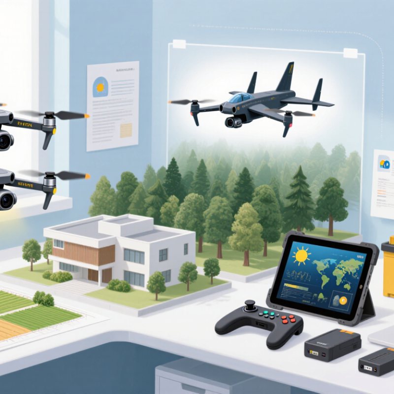
Airframe choice starts with the shape of the job, not an advertised range. A multirotor can hover over a fence line, inspect a roof edge, and land in a small clear area. It suits compact routes where detail matters more than distance. Its battery can limit coverage, especially in wind. Shorter flights may mean more battery changes and setup time.
A fixed-wing aircraft can cover broad, open areas efficiently, such as fields or long stretches of coastline. It usually needs room to launch and recover, and it cannot hover over a point. A VTOL combines vertical takeoff and landing with wing-borne flight, which can help where space is limited but routes are larger. That flexibility adds mechanical and operational complexity. I would compare planned coverage with real flight time, including turns, wind, image overlap, and a safe return reserve. Range figures alone can mislead.
Tips: Sketch the route and mark launch sites, obstacles, and inspection points. Estimate useful coverage per flight, not theoretical distance. If the mission includes both close inspection and wide mapping, test whether one airframe can do both well. Sometimes the compromise is real.
Compare Payload and Endurance Using Real Mission Loads, Not Advertised Maximums
How to Choose the Best Unmanned Aircraft in 2026?
A payload rating is not a mission plan. Weigh the full working setup: sensor, mount, cables, protective housing, and battery. Then test it in the wind and temperature your crew actually expects. A camera that weighs 1.2 kilograms on a bench may need a heavier mount and vibration isolators in flight. Small additions count. So does a cold battery.
The FAA’s 2024 Aerospace Forecast estimated about 412,000 commercial small unmanned aircraft in the United States in 2023. That fleet estimate shows adoption, not real-world endurance; the report does not measure flight time under working payloads. Ask vendors for logs from comparable missions, including takeoff weight, wind, temperature, flight profile, and landing reserve. Better yet, run repeat flights with your own equipment. Record time to the planned landing threshold, not time until the aircraft can no longer stay aloft. A modest reserve matters.
Compare useful minutes at mission weight, not the empty-aircraft figure. If a mapping flight needs 28 minutes on site, a test that delivers 30 minutes total is a poor fit. That margin is thin. Battery age and route changes can erode it further. One detail is easy to miss: payload can alter balance and control effort, not merely add weight. Keep the test imperfect but honest; record failed runs and changing conditions. Then choose the aircraft whose verified payload-endurance curve fits the task, with room for ordinary surprises.
How to Choose the Best Unmanned Aircraft in 2026? Compare Payload and Endurance Using Real Mission Loads, Not Advertised Maximums
Planning guide: The figures below are indicative ranges for representative aircraft classes, not specifications for a particular model. “Loaded endurance” assumes the stated mission payload, a practical flight profile, and a landing reserve of about 20%; actual results vary with aircraft design, weather, altitude, battery or fuel condition, and operating rules.
Check Regulatory Limits: FAA Part 107 Sets 55 lb and 400 ft AGL Caps
How to Choose the Best Unmanned Aircraft in 2026?
Under FAA Part 107, a small unmanned aircraft must weigh less than 55 pounds at takeoff, including attached equipment and payload. The usual altitude limit is 400 feet above ground level. Near a structure, operators may fly up to 400 feet above its uppermost point, subject to the rule’s conditions. These limits affect real buying decisions. A heavier camera, thermal sensor, or battery can push a planned setup over the weight threshold. Check the complete takeoff configuration, not just the aircraft’s advertised weight.
The FAA’s 2024–2044 Aerospace Forecast estimates the U.S. commercial small-UAS fleet will grow from about 966,000 aircraft in 2023 to 1.18 million by 2028. More aircraft mean more crowded airspace and greater need for careful mission planning. A model that can technically reach higher is not automatically suitable for routine work. Confirm its operating instructions, payload capacity, and flight-control settings against Part 107 requirements. Small details matter.
Before choosing, write down the payload, takeoff weight, and maximum operating height for each mission. Then compare those figures with the FAA’s rules in 14 CFR Part 107, especially sections 107.3 and 107.51. Leave a practical margin below the weight cap; accessories and last-minute changes can add weight. I have seen a neat specification sheet create false confidence. Field conditions are less tidy.
Verify Operating Rules: EASA Open Category Limits Height to 120 m and Weight to 25 kg
When choosing an unmanned aircraft in 2026, check its operating limits before comparing camera range or flight time. In the EASA Open category, the general maximum height is 120 metres above the closest point of the ground. This is not always 120 metres above your launch spot, especially on sloping terrain. A hillside can change the practical clearance quickly. That matters.
The aircraft’s maximum take-off mass must be below 25 kilograms for Open-category operations, with batteries and any carried equipment included. A heavier setup may require a different operating category and additional steps. Weight figures on a product page may describe the aircraft without its full payload, so verify the configuration you plan to fly. Also check the applicable subcategory, distance-from-people rules, pilot competency requirements, and local airspace restrictions. These can narrow where and how you may operate, even when the aircraft meets the height and weight limits. Keep the official EASA guidance and local notices close when planning a flight; a familiar field can still have restrictions. I have found that a simple pre-flight note with planned height, route, and aircraft mass prevents avoidable assumptions. It is easy to overlook one detail.