Top Drone Surveying Tips for Accurate Data Collection?
Drone surveying is transforming how we collect data. This technology offers both speed and accuracy. However, achieving the best results requires thoughtful planning and execution.
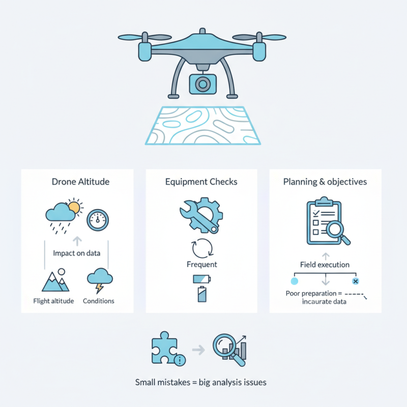
Many professionals overlook key aspects that influence data quality. Factors like flight altitude and weather conditions matter significantly. Pilots need to understand how these variables impact their results. Frequent equipment checks are also essential to avoid unexpected errors.
Planning is vital to a successful drone surveying project. Poor preparation can lead to inaccurate data. It’s crucial to define clear objectives before heading into the field. This ensures that every flight will meet specific data collection needs. Remember, even small mistakes can lead to big issues in the analysis.
Understanding the Basics of Drone Surveying Techniques
Drone surveying has transformed the way we collect geographical data. Understanding basic drone surveying techniques is crucial for obtaining accurate results. A recent study revealed that over 80% of surveyed professionals rely on drones for mapping and surveying tasks. The ability to capture high-resolution images helps detect changes in terrain and land use effectively.
To start, it's essential to calibrate the drone correctly. This often gets overlooked. Proper calibration ensures that the data collected reflects true ground conditions. Specific flight patterns can enhance coverage and detail. For example, using grid patterns often results in better data density. It’s not always perfect, though; inconsistent weather conditions can still affect outcomes.
Another key aspect is the choice of software for data processing. Many rely on various programs, yet few maximize their potential. Understanding the software's features can significantly improve data quality. Recognizing limitations in processing can lead to unexpected errors. A startling 30% of surveyors report issues due to suboptimal data management practices. This highlights the need for continual learning and adaptation in drone surveying.
Choosing the Right Drone for Your Surveying Needs
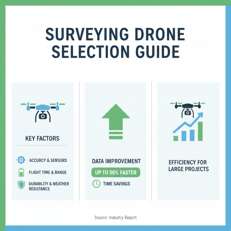
Choosing the right drone for surveying is crucial. Many factors influence the decision. A high-quality drone can greatly improve data accuracy. According to a recent industry report, drones can reduce surveying time by up to 50%. This efficiency is essential for large projects.
When selecting a drone, consider your surveying needs. Check payload capacity. Some drones can carry multiple cameras and sensors. Additionally, look at flight duration. Drones with longer battery life allow for larger areas to be covered. A professional-grade drone can cost between $5,000 to $30,000. This investment pays off in data reliability.
Common mistakes include underestimating the terrain. Uphill or dense areas may require specialized drones. Not all drones are suitable for harsh weather conditions. It’s important to evaluate the environment where the survey takes place. With the right drone, you can achieve precise measurements. However, be prepared to adapt if conditions change. This flexibility is key to successful surveying.
Preparing Your Site for Optimal Data Collection
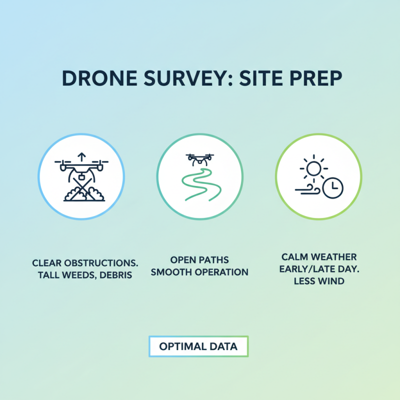
Preparing your site for optimal data collection is crucial for drone surveying. Start by clearing the area. Remove tall weeds, debris, or anything that could obstruct the drone’s line of sight. Ensure paths are clear to allow for smooth drone operation. Consider the weather as well. Windy conditions can affect accuracy. Early mornings or late afternoons often provide calmer skies.
Next, survey the terrain carefully. Look for elevation changes or structures that might interfere. Document any obstacles you notice, even small ones. They can cast shadows or create confusion in your data later on. Check for reflective surfaces too. They may skew results if drones pick up unnecessary data reflections.
Lastly, communicate with your team about the plan. Discuss any potential challenges. Not everyone may be aware of what to expect on-site. Knowing the layout and possible issues helps in making adjustments quickly. Being unprepared can lead to mistakes and poor data collection. Always leave room for learning. Each survey teaches something new, increasing your efficiency and accuracy over time.
Best Practices for Capturing High-Quality Aerial Images
In aerial surveying, capturing high-quality images is essential. The clarity and precision of drone images can significantly impact data interpretation. According to a report by the National Academy of Sciences, accurately captured aerial data can enhance decision-making in industries like agriculture and construction.
One effective tip is to plan your flight path meticulously. Use software that calculates optimal routes based on obstacles and area size. This improves coverage and minimizes the chance of missing critical data. Pay attention to weather conditions too. Windy days can lead to shaky images, affecting the quality of the data collected.
Another point to consider is the GSD (Ground Sample Distance). A lower GSD means higher resolution images, but it also requires precise altitudes and overlaps between images. Striking a balance is vital. Remember, over-saturating your image capture can lead to unnecessary data processing time, reducing efficiency.
Lastly, ensure the drone's camera settings are optimized before each flight. Adjust settings like ISO, shutter speed, and aperture based on lighting conditions. Inconsistent settings can lead to images that are either too bright or too dark, complicating analysis and interpretation.
Analyzing and Interpreting Data for Accurate Results
Accurate data collection through drone surveying relies heavily on careful analysis and interpretation. Start by organizing data efficiently. Raw data can be overwhelming. Use software tools that help visualize information clearly. Color-coded maps can reveal trends at a glance. Be mindful of potential errors in data capture. Misalignment or signal loss can lead to misleading results.
Analyzing data involves more than just numbers. Consider environmental factors that can affect surveys. Weather plays a big role in data quality. Clouds and wind can disrupt drone flight patterns. Reflect on the elevation differences in your surveyed area. Peaks and valleys may skew data if not accounted for properly.
At this stage, good interpretation is crucial. Look for patterns and anomalies. Spot errors or unexpected results early on. Collaborate with colleagues to gain diverse insights. This approach can reveal overlooked details. Always question your findings. Why do some areas show discrepancies? Taking the time to understand this can elevate the quality of your work significantly.