What is Drone Surveying and How Can It Benefit Your Business?
Drone Surveying is revolutionizing the way businesses collect and analyze data. According to a study by MarketsandMarkets, the drone services market is projected to grow from $4.4 billion in 2020 to $63.6 billion by 2025. This rapid growth highlights the increasing reliance on drone technology across various sectors.
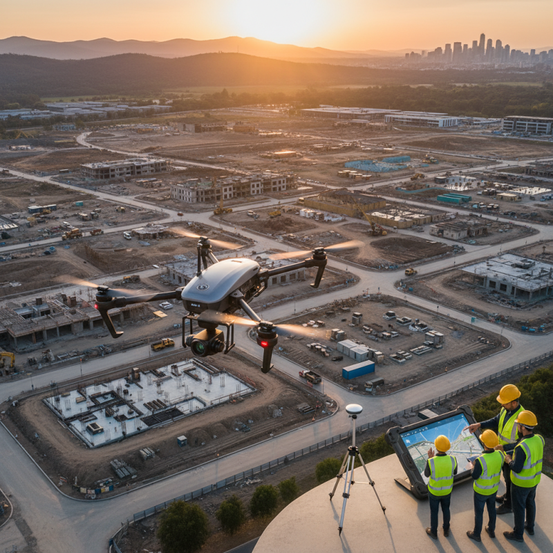
The integration of Drone Surveying can lead to significant efficiency gains. For example, construction projects that utilize drones can reduce surveying time by up to 75%. Drones provide high-resolution aerial imagery, enabling precise data collection that was once time-consuming and costly. However, companies must carefully consider these investments, as transitioning to drone technology involves training and potential regulatory challenges.
While the benefits are clear, businesses should approach Drone Surveying with a critical mindset. Not every application is suitable for drones, and mismanaged expectations can lead to unsatisfactory results. Evaluating the specific needs and limitations of your business is essential. In a rapidly evolving market, staying informed will help maximize the advantages that Drone Surveying offers.
Understanding Drone Surveying: Definition and Key Concepts
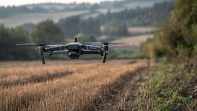
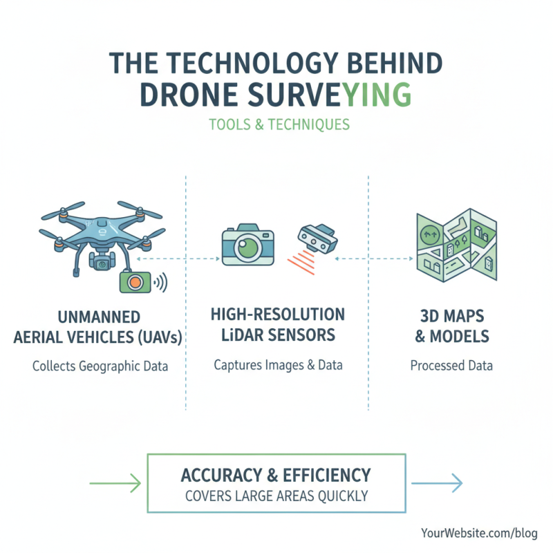
Drone surveying is a modern technique used for land measurement and mapping. This method leverages advanced drone technology to capture detailed aerial images and data. It enables surveyors to obtain precise topographical maps and 3D models. This accuracy can transform the landscape of various industries.
Understanding the key concepts of drone surveying is essential for businesses. Drones can cover large areas quickly, reducing the time and cost associated with traditional surveying methods. However, the technology does have limitations. The quality of the data depends on weather conditions and the drone's capabilities.
Integrating drone surveying into your operations can yield significant benefits. It enhances efficiency and improves decision-making. Still, companies must assess their specific needs. Relying solely on technology could lead to oversight of important factors. Balancing aerial data with traditional methods may provide a more comprehensive understanding.
Drone Surveying Benefits for Businesses
Advantages of Drone Surveying for Various Industries
Drone surveying has emerged as a game-changer across various industries. The accuracy and speed of drone technology can significantly enhance data collection. According to a 2021 report by MarketsandMarkets, the drone surveying market is projected to grow from $4.4 billion in 2020 to $16.4 billion by 2025. This growth illustrates how businesses are increasingly recognizing the value of drones.
Construction and agriculture are among the industries benefiting most from drone surveying. In construction, drones can complete land surveys up to 5 times faster than traditional methods. This speed reduces project timelines and cuts down costs. In agriculture, farmers can use drones for crop monitoring. Studies show that drone technology can increase crop yields by up to 15%. This indicates a substantial return on investment for those who adopt the technology early.
However, the implementation of drone surveying is not without challenges. Regulatory hurdles and technical limitations can hinder progress. Some businesses may struggle to integrate drones into existing workflows. Additionally, ensuring data security and privacy remains a critical issue. Companies must navigate these complexities to fully leverage drone surveying’s potential benefits. While the advantages are clear, businesses must also address these concerns to realize the full value of this technology.
What is Drone Surveying and How Can It Benefit Your Business?
| Industry |
Benefits of Drone Surveying |
Cost Reduction (%) |
Time Savings (%) |
| Construction |
Accurate site measurements, faster project planning |
20% |
30% |
| Agriculture |
Precision crop monitoring, improved yield prediction |
25% |
40% |
| Real Estate |
Enhanced property marketing, high-quality aerial images |
15% |
25% |
| Environmental Monitoring |
Efficient landscape mapping, wildlife tracking |
30% |
50% |
| Mining |
Quarry planning, stockpile measurement |
20% |
35% |
Implementing Drone Surveying: Steps for Businesses
Implementing drone surveying can transform how businesses gather data and analyze their landscapes. Start by identifying the key areas where drones can add value, such as construction sites or agricultural fields. Next, assess your current processes. Are they efficient? How often do you encounter errors?
Drone technology can reduce manual labor and improve accuracy.
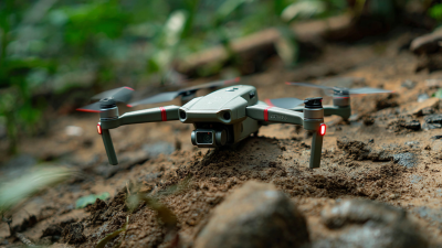
Once you've recognized the potential benefits, determine the necessary equipment. Drone selection depends on your specific needs. High-resolution cameras or LiDAR sensors may be required for precise data collection. Training staff is also critical. They must understand how to operate drones safely and effectively.
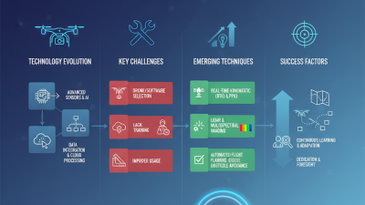
Pilot testing is an essential step. Conduct trials to assess the quality of the data collected. Review the outcomes to identify areas for improvement. Some challenges may arise during this phase, including technical issues or regulatory hurdles. Be open to adjustments in your approach. Continuous learning and adaptation are key to fully harnessing the power of drone surveying within your business.
Regulatory Considerations and Best Practices in Drone Surveying
Drone surveying is transforming industries by providing precise data quickly. However, businesses must navigate regulatory considerations to maximize benefits. The Federal Aviation Administration (FAA) has specific guidelines for commercial drone use. Compliance with Part 107 regulations is essential for safety and legality. Understanding altitude restrictions and airspace classifications is also necessary.
An essential aspect is obtaining required permissions. Securing a Certificate of Waiver or Authorization (COA) may be necessary for certain operations. Additionally, staying updated on local laws minimizes risks. A study by Drone Industry Insights revealed that the drone surveying market is expected to grow by 45% annually.
Best practices in data collection are crucial. Utilizing proper sensors and cameras improves accuracy. Training staff to follow protocols ensures reliable outcomes. Regular maintenance of equipment is a necessity to uphold standards. Companies must reflect on past projects for continuous improvement. Each flight provides learning opportunities that can shape future operations.